The 10th annual meeting of the Remote Sensing Working Group of the German Geographical Society (DGfG) took place on October 6 and 7, 2022, in Halle (Saale) at the Institute of Earth Sciences and Geography of Martin Luther University Halle-Wittenberg. The theme was:
Product4Practice – Remote Sensing Between Research and Application
The development of robust solutions to problems across a wide range of disciplines often involves upscaling field data to remote sensing data at various spatial and temporal scales. Given today’s diversity of platforms and sensors—particularly in light of dynamic developments in the field of UAVs—this represents a significant scientific and technical challenge.
At the same time, it is essential to maximize the potential for utilizing the acquired know-how and developed solutions. Scientific findings and product developments should reach a wide range of application fields and user groups, even beyond the remote sensing community.
Against this backdrop, the meeting of the Remote Sensing Working Group focused on the complex chain of developing innovative products and services. This includes topics such as in-situ data acquisition, upscaling to multiscale and multisensory remote sensing data, as well as practical application scenarios and the successful transfer of knowledge and innovation to industry and society.
The meeting provided insights into current application-oriented research projects and served as a platform for discussing challenges and solutions in the field of research and technology transfer. In addition, the meeting showcased success stories from spin-offs and startups.
In addition to exciting keynotes and presentations, participants were treated to hands-on workshops and poster presentations. A social gathering took place on the evening of October 6. There was also an opportunity to explore the city of Handel on the Saale River during a guided tour.
Thank you very much for your contributions and your participation!
Christopher Conrad
(on behalf of the Remote Sensing Working Group and colleagues Prof. Dr. Siegmund, Prof. Dr. Hochschild und Prof. Dr. Jürgens)
Local organizer/contact person:
Team Remote Sensing Working Group Halle 2022
Martin-Luther-Universität Halle-Wittenberg
Institut für Geowissenschaften und Geographie
Fachgebiet Geoökologie
Program – Overview
| Time | Thursday, 06.10.2022 |
|---|---|
| 08:00 – 10:30 | Registration |
| 08:30 – 10:00 | Workshops |
| 10:00 – 10:30 | Coffee |
| 10:30 – 10:45 | Welcome |
| 10:45 – 11:30 | Keynote Talk I |
| 11:30 – 13:00 | Session 1: Remote Sensing Science |
| 13:00 – 14:00 | Lunch |
| 14:00 – 15:30 | Session 2: Remote Sensing Science |
| 15:30 – 17:00 | Posters´n´Coffee I |
| 17:15 – 19:00 | Guided city tour |
| 19:00 – | Dinner (Hallesches Brauhaus) |
| Time | Friday, 07.10.2022 |
|---|---|
| 08:30 – 9:00 | Registration |
| 09:00 – 9:45 | Keynote talk II |
| 09:45 – 10:15 | Posters´n´Coffee II |
| 10:15 – 12:00 | Session 3: How to start-up |
| 12:00 – 13:00 | Lunch |
| 13:00 -14:30 | Session 4: Transfer projects |
| 14:30 – 15:00 | Wrap up & farewell |
Program
| Time | Friday, 07.10.2022 |
|---|---|
| 08:30-9:00 | Registrierung |
| 09:00-9:45 | Keynote: University2Practice – Als Start-Up Fernerkundungslösungen für die Landwirtschaft entwickelnDamian Bargiel |
| 09:45-10:15 | Posters´n´Coffee |
| 10:15-12:00 | Session 3: How to start-up (Chair: Moritz Bradler) |
| 10:15-10:30 | Gründung als Karriereoption aus der Wissenschaft & Unterstützungsangebote seitens der Hochschulen |
| 10:30-11:30 | Vorträge und Q&A der Startups GREENSPIN – Gunther Schorcht, MUST Analytics GmbH – Mirkhagan Mustafazade, nadar – Caroline Busse, PAAWR– Pauline Neuholz |
| 11:30-12:00 | Moderierte Diskussion mit allen Startups |
| 12:00-13:00 | Mittagspause |
| 13:00-14:30 | Session 4: Transfer projects (Chair: Christopher Conrad) |
| 13:00-13:15 | Der Waldzustandsmonitor – ein Wissenstransferprojekt Daniel Doktor Abstract – Presentation |
| 13:15-13:30 | Geo Engine: Ein dynamischer Data Cube für interaktive Analysen und VerarbeitungsPipelines Johannes Drönner Abstract – Presentation |
| 13:30-13:45 | Remote sensing-based agricultural early drought detection system for Aral Sea Basin: development and applications Muhammad Usman Presentation |
| 13:45-14:00 | „Saatguthersteller goes remote sensing“ – Fusion von Fernerkundung, landwirtschaftlicher Expertise und Geschäftsprozessen Irmgard Runkel Abstract – Presentation |
| 14:00-14:15 | FERN.Lab: knowledge and technology transfer from science to market and society Daniel Spengler Abstract – Presentation |
| 14:15-14:30 | East and West, Science and Society – Revisiting the Interactive Mediation of Earth Observation Data Literacy with EO College Henryk Hodam Abstract – Presentation |
| 14:30-15:00 | Verabschiedung |
| Poster presentations |
|---|
| Deciphering small-scale periglacial surface dynamics in alpine environments using DInSAR time series analysis Sebastian Buchelt |
| Spatial and temporal patterns of smallholder farming systems in East Africa Adomas Liepa |
| Assessing the applicability of interferometric and polarimetric time series derived from Sentinel-1 for tracking phenological developments of crops at the JECAM site DEMMIN (Germany) Johannes Löw |
| Deutschlandweite Baumartenkartierung unter Verwendung von Sentinel-2 Satellitendaten Sebastian Preidl |
| Einfluss der klimabedingten Veränderung der Baumartenverbreitung auf Natura-2000 Gebiete Anne Reichmuth |
| Drought-induced tree mortality of European beech under the influence of smallscale heterogeneity in edaphic and topographic properties and tree neighbourhood composition Julia Rieder |
| Use of Sentinel 2 and MODIS remote sensing data to localize drought-induced yield losses in DEMMIN, Mecklenburg-Western Pomerania Dennis Sakretz |
| Intercomparison of current soil moisture products from remote sensing and reanalysis over COSMOS-Europe field sites in Germany Toni Schmidt |
| Vergleichsstudie zur Abschätzung der Nutzungsintensität aus Satellitendaten Marcel Schwieder |
Social Events
- Dinner, 6. Oktober 2022, ab 19:00 Uhr
Hallesche Spezialitätenbrauerei – Große Nikolaistr. 2, 06108 Halle (Saale) – Selbstzahler/innen – halleschesbrauhaus.de - Guided City Tour, 6. Oktober 2022, 17:30 Uhr ggf. auch am 7. Oktober, ca. 15:30 Uhr
Hallesche Altstadt – 5 €, Zahlung vor Ort.
Workshops
| CODE-DE/EO-Lab |
| 6.10.2022 – 8:30-10:00 Uhr |
| Led by: Patricia Salort – Urbetho CF GmbH |
| Description: The workshop, structured as a tutorial, included an approximately 20-minute introduction to the CODE-DE and EO-LAB platforms. This was followed by a hands-on session on the CODE-DE Datacube and JupyterLab. The tutorial took place in the computer lab of the Department of Earth Sciences and Geography. Computers were provided, and participants were also welcome to use their own laptops. |
| Location: PC-Pool of the Institut für Geowissenschaften und Geographie, Von-Seckendorff-Platz 4, 06120 Halle (Saale), Raum H4 3.32 |
| UAV-Hyperspektralanalyse mit ENVI |
| 6.10.2022 – 8:30-10:00 Uhr |
| Led by: Dr. Thomas Bahr – L3Harris Geospatial |
| Description: The workshop, conducted as a tutorial, presented several methods for analyzing modern hyperspectral UAV data for geological and mineralogical applications using the ENVI software, based on selected practical exercises. Various steps required for the evaluation of airborne HySpex images, which are already available as orthorectified reflectance data, were walked through. The images were recently captured during a UAV demonstration by NEO (Norsk Elektro Optikk AS) in the Cuprite Mining District, Nevada. Steps: Brief introduction to the ENVI user interfacePreparation of image data (cropping, spectral subset, vegetation masking)Comparison of image spectra with external spectral librariesExtraction of endmembers from UAV data (Minimum Noise Fraction Transformation, Pixel Purity Index, n-D Visualizer, Spectral Analyst) Classification of endmembers (Spectral Angle Mapper, Spectral Feature Fitting, Rule Classifier)The tutorial concluded with a brief introduction to the ENVI Modeler, which allows users to create custom workflows without writing a single line of code. With a single click, your image data can then be processed in batches in the cloud, and IDL or Python programs can be generated from the models. |
| Location: PC-Pool of the Institut für Geowissenschaften und Geographie, Von-Seckendorff-Platz 4, 06120 Halle (Saale), Raum H4 3.34 |
Venue
Martin-Luther-Universität Halle-Wittenberg
Institut für Geowissenschaften und Geographie
Von-Seckendorff-Platz 3 und 4
06120 Halle (Saale)
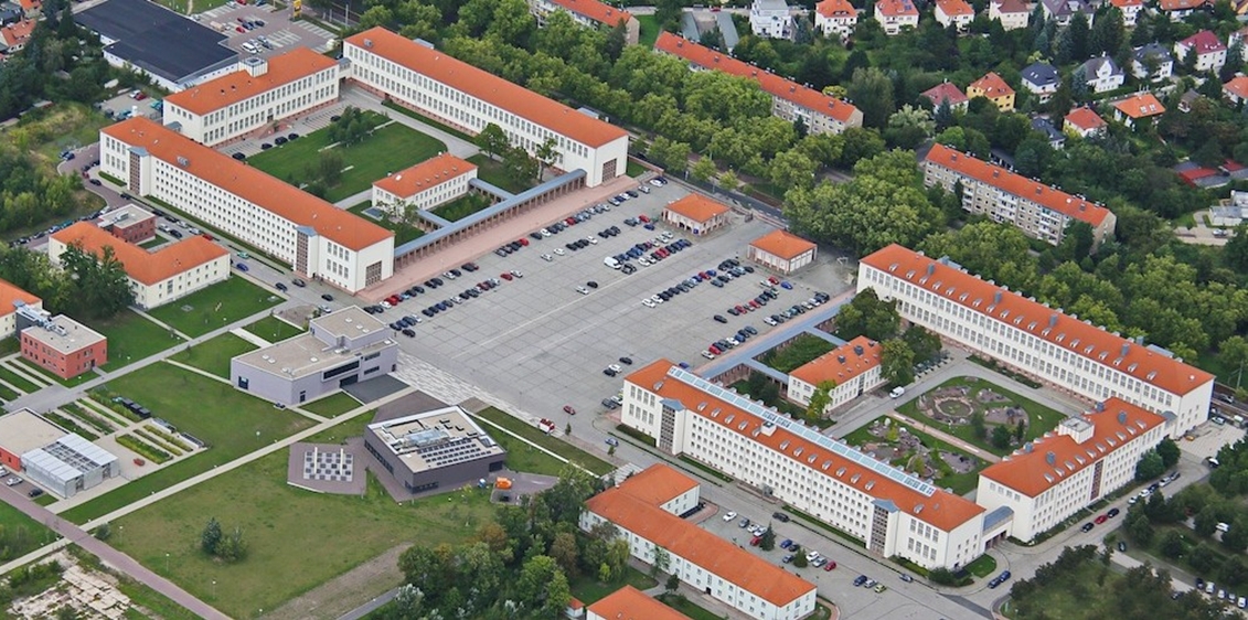
© CampusMaps der MLU 2014, Institut für Geowissenschaften und Geographie
Accommodations
Hotels offering special rates for MLU guests:
- Ankerhof Hotel (Stichwort “MLU-Rabatt“) ankerhof.de
- Apart-Hotel Halle (Buchungscode „MLU Halle-Wittenberg“) apart-halle.de
Other accommodations in various price ranges:
- B&B Hotel hotel-bb.com/de/stadt/hotels-halle-saale
- Dorint Hotel Charlottenhof hotel-halle-saale.dorint.com
- Dormero Hotel Halle dormero.de/hotel-halle
- Jugendherberge Halle jugendherberge.de/jugendherbergen/halle-763/portraet
- Hostel No5 hostel-no5.de
- Hotel am Steintor am-steintor.de
- Hotel Atlas hotel-atlas-halle.business.site/
- Hotel ibis Styles Halle ibis-styles-halle-saale.hotel-mix.de
- Hotel Marthahaus stiftung-marthahaus.de/hotel/hotel/
- Hotel Schweizer Hof schweizer-hof.com
- Niu Ridge City Hotel-Halle the.niu.de/hotels/deutschland/halle/the-niu-ridge
- Tryp Hotel Halle tryphalle.com
Directions
Visitors arriving by train can reach the venue from the main station by taking tram no. 4 or 5 toward Kröllwitz and getting off at the Straßburger Weg stop. From downtown, you can reach the campus by taking tram no. 5 toward Kröllwitz and getting off at the Straßburger Weg stop.
Ample parking is available on campus